Met Office Issues Severe Weather Warnings as Heavy Rain Threatens Northern Ireland
In This Article
HIGHLIGHTS
- The Met Office has issued thunderstorm and heavy rain warnings for Northern Ireland, with potential rainfall of 50-75mm in 12-18 hours.
- Eastern and south-eastern parts of Northern Ireland are under a 24-hour weather warning from Sunday evening to Monday evening.
- Heavy rain could lead to localized flooding and travel disruptions, with similar warnings in place for parts of England and Scotland.
- The Republic of Ireland has a yellow alert for heavy rain in several counties, valid from midnight to noon on Monday.
- Climate change is contributing to more frequent and intense rainfall events across Europe.
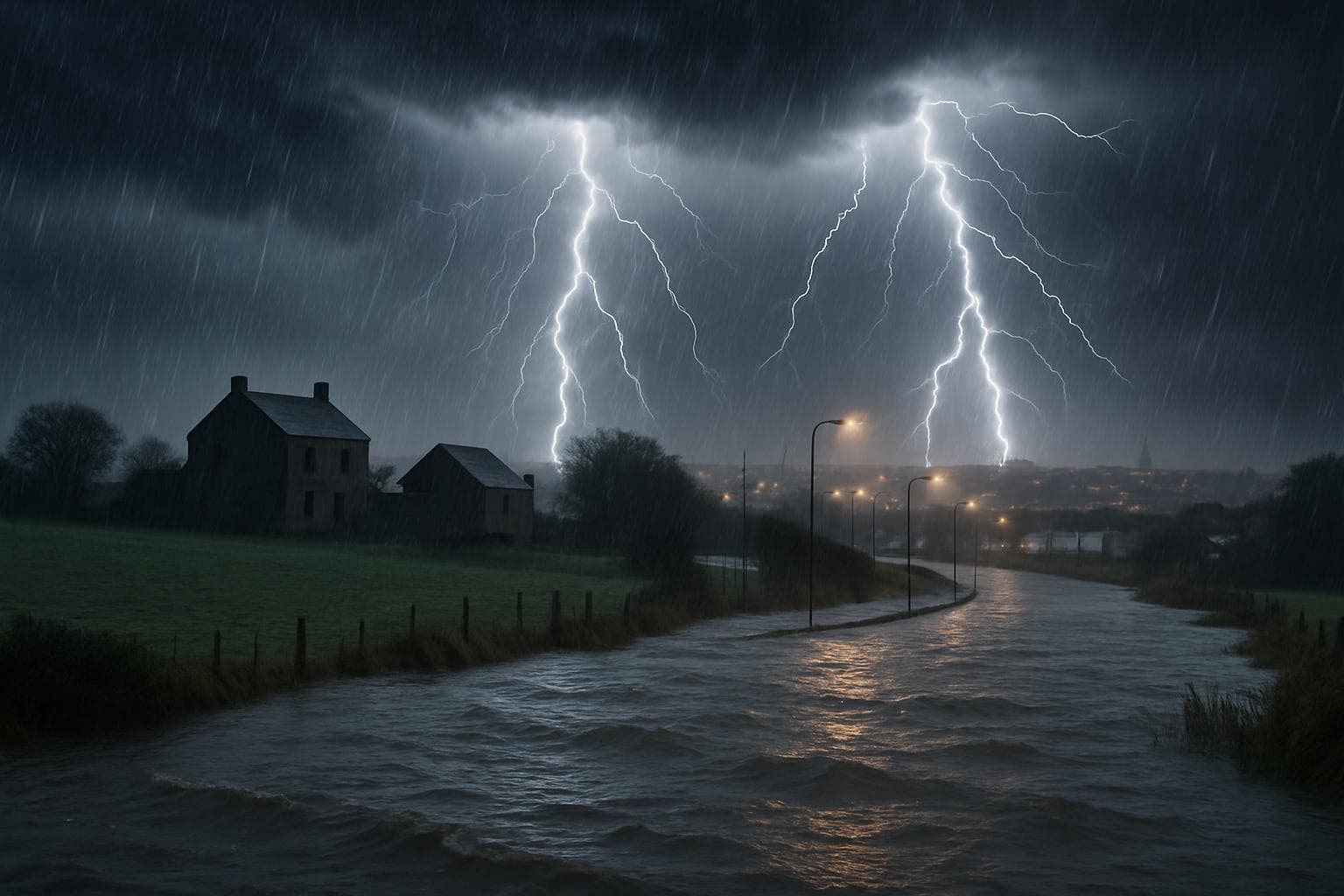
The Met Office has issued a series of severe weather warnings for Northern Ireland, predicting significant rainfall and thunderstorms that could lead to flooding and travel disruptions. The warnings, which came into effect on Sunday afternoon, are expected to remain in place until Monday evening.
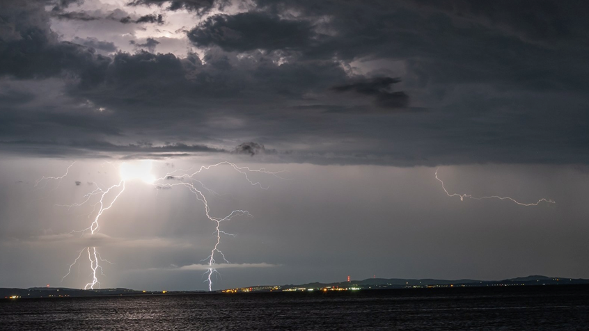
Thunderstorm Alerts and Rainfall Predictions
Counties Londonderry, Tyrone, and Fermanagh are under a thunderstorm warning until 8:00 PM BST on Sunday. The Met Office forecasts that these areas could experience heavy downpours, lightning strikes, and hail. Meanwhile, a separate warning for heavy rain has been issued for eastern and south-eastern counties, including Antrim, Down, and Armagh, effective from 6:00 PM BST on Sunday until 6:00 PM BST on Monday. Rainfall in these regions could reach 50-75mm within 12-18 hours, potentially causing localized flooding.
Broader UK and Ireland Weather Warnings
The impact of this weather system is not confined to Northern Ireland. The Met Office has also issued yellow weather warnings for parts of England and Scotland, where 20-40mm of rain could fall in just two hours on Monday. In the Republic of Ireland, Met Éireann has placed a yellow alert for counties Dublin, Kildare, Louth, Meath, Wicklow, and Monaghan, valid from midnight to noon on Monday.
Climate Change and Extreme Weather
The recent spate of extreme weather events, including this heavy rainfall, is attributed to climate change, which is causing more intense and frequent rainfall across Europe. Warmer air holds more water vapor, leading to heavier downpours. Simon Partridge, a Met Office forecaster, highlighted that Northern Ireland could see the most impactful rainfall, with more than half a month's average rainfall expected in less than a day.
WHAT THIS MIGHT MEAN
As the weather warnings remain in effect, residents in the affected areas should prepare for potential flooding and travel disruptions. Emergency services may face increased demand, and infrastructure could be tested by the heavy rainfall. In the longer term, these extreme weather events underscore the urgent need for climate adaptation strategies to mitigate the impacts of climate change. Policymakers may need to consider investing in improved drainage systems and flood defenses to better protect vulnerable communities.
Images from the Web
Related Articles

Saharan Dust to Illuminate UK Skies with Vivid Sunrises and Sunsets

Avalanche Risks Surge Amidst Extreme Weather Conditions in California and Europe

Tragedy Strikes County Armagh: Three Dead in Multi-Vehicle Collision

Government Announces £4 Billion Overhaul of SEND Support in England

UK Government Announces Major Overhaul of SEND System with £3.4 Billion Investment

Government Unveils Ambitious Plan to Halve Attainment Gap in England's Schools
Met Office Issues Severe Weather Warnings as Heavy Rain Threatens Northern Ireland
In This Article
 Leila Hassan| Published
 HIGHLIGHTS
- The Met Office has issued thunderstorm and heavy rain warnings for Northern Ireland, with potential rainfall of 50-75mm in 12-18 hours.
- Eastern and south-eastern parts of Northern Ireland are under a 24-hour weather warning from Sunday evening to Monday evening.
- Heavy rain could lead to localized flooding and travel disruptions, with similar warnings in place for parts of England and Scotland.
- The Republic of Ireland has a yellow alert for heavy rain in several counties, valid from midnight to noon on Monday.
- Climate change is contributing to more frequent and intense rainfall events across Europe.
The Met Office has issued a series of severe weather warnings for Northern Ireland, predicting significant rainfall and thunderstorms that could lead to flooding and travel disruptions. The warnings, which came into effect on Sunday afternoon, are expected to remain in place until Monday evening.
Thunderstorm Alerts and Rainfall Predictions
Counties Londonderry, Tyrone, and Fermanagh are under a thunderstorm warning until 8:00 PM BST on Sunday. The Met Office forecasts that these areas could experience heavy downpours, lightning strikes, and hail. Meanwhile, a separate warning for heavy rain has been issued for eastern and south-eastern counties, including Antrim, Down, and Armagh, effective from 6:00 PM BST on Sunday until 6:00 PM BST on Monday. Rainfall in these regions could reach 50-75mm within 12-18 hours, potentially causing localized flooding.
Broader UK and Ireland Weather Warnings
The impact of this weather system is not confined to Northern Ireland. The Met Office has also issued yellow weather warnings for parts of England and Scotland, where 20-40mm of rain could fall in just two hours on Monday. In the Republic of Ireland, Met Éireann has placed a yellow alert for counties Dublin, Kildare, Louth, Meath, Wicklow, and Monaghan, valid from midnight to noon on Monday.
Climate Change and Extreme Weather
The recent spate of extreme weather events, including this heavy rainfall, is attributed to climate change, which is causing more intense and frequent rainfall across Europe. Warmer air holds more water vapor, leading to heavier downpours. Simon Partridge, a Met Office forecaster, highlighted that Northern Ireland could see the most impactful rainfall, with more than half a month's average rainfall expected in less than a day.
WHAT THIS MIGHT MEAN
As the weather warnings remain in effect, residents in the affected areas should prepare for potential flooding and travel disruptions. Emergency services may face increased demand, and infrastructure could be tested by the heavy rainfall. In the longer term, these extreme weather events underscore the urgent need for climate adaptation strategies to mitigate the impacts of climate change. Policymakers may need to consider investing in improved drainage systems and flood defenses to better protect vulnerable communities.
Images from the Web
Related Articles
Saharan Dust to Illuminate UK Skies with Vivid Sunrises and Sunsets
Avalanche Risks Surge Amidst Extreme Weather Conditions in California and Europe
Tragedy Strikes County Armagh: Three Dead in Multi-Vehicle Collision
Government Announces £4 Billion Overhaul of SEND Support in England
UK Government Announces Major Overhaul of SEND System with £3.4 Billion Investment
Government Unveils Ambitious Plan to Halve Attainment Gap in England's Schools